Explore the three volcanoes of the Cerová vrchovina
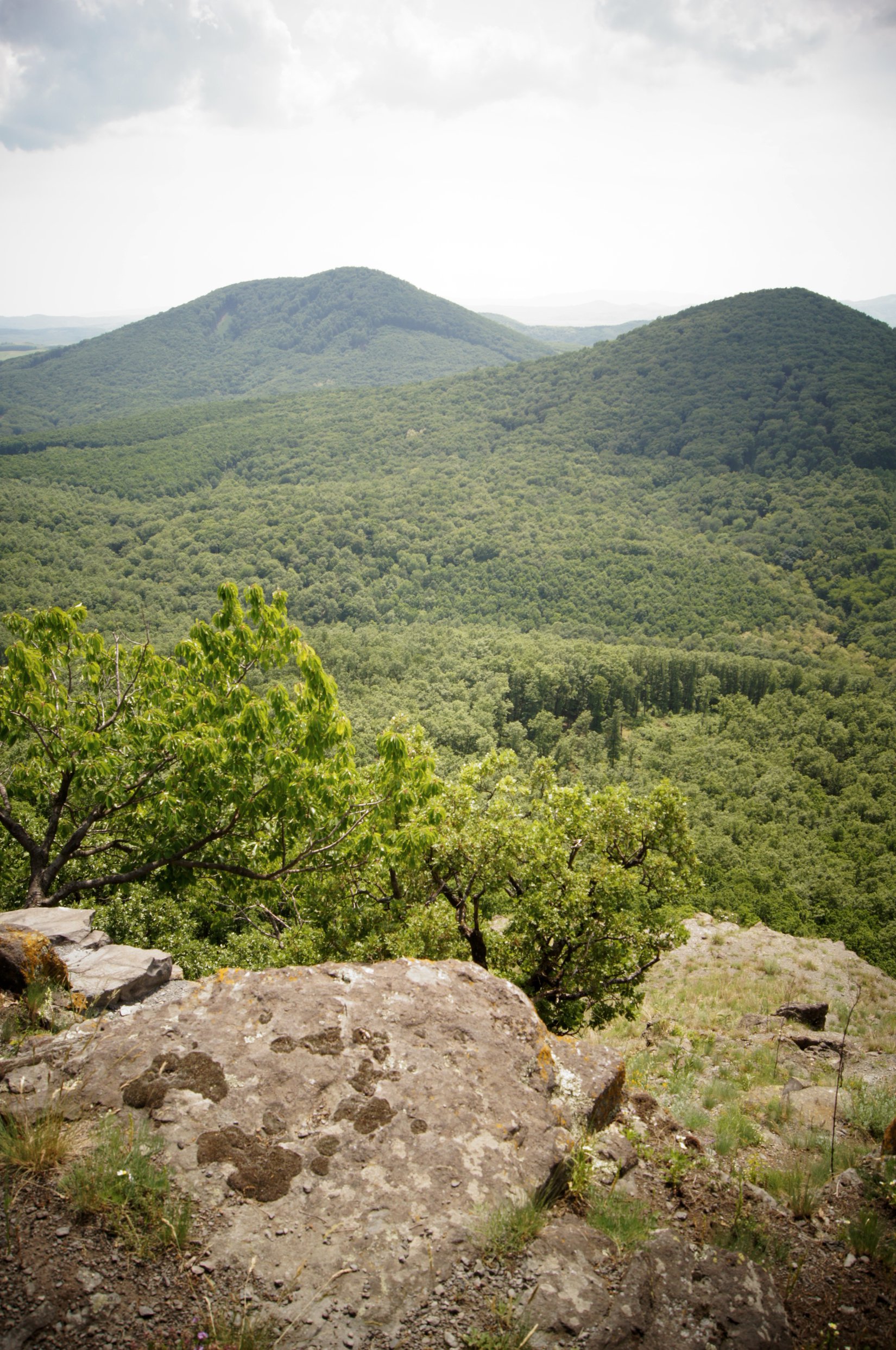
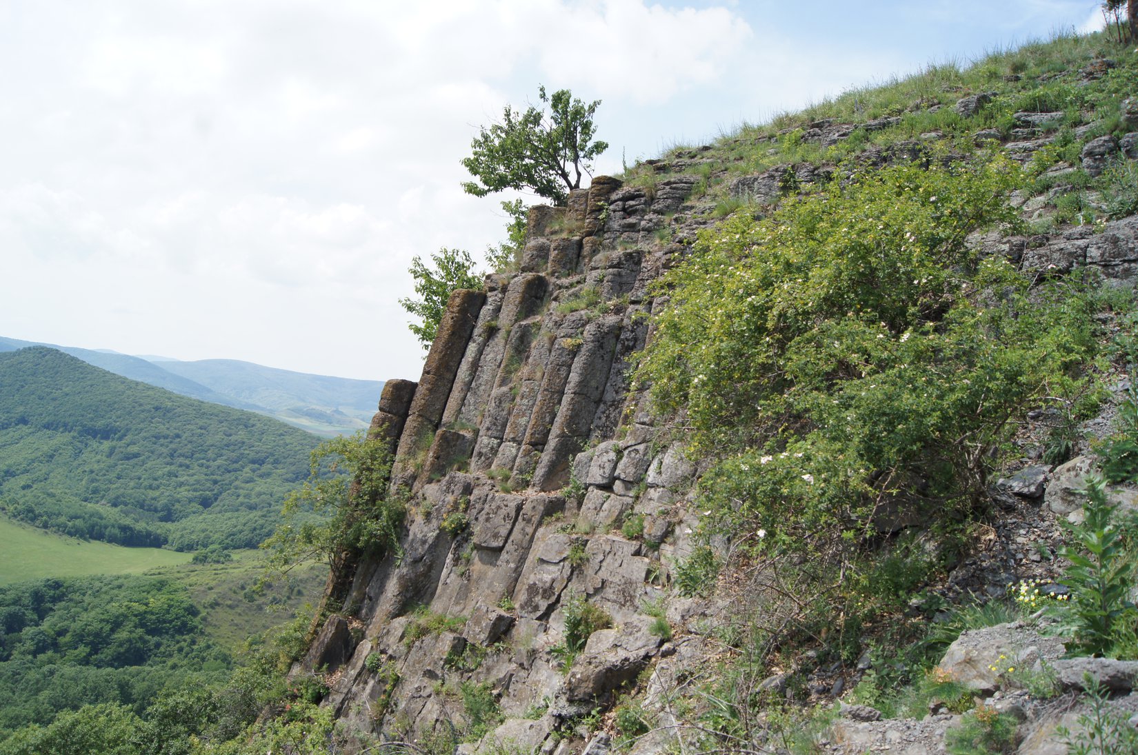
From the center of Hajnáčka, we follow the yellow-marked tourist route around the castle hill northeast to the first of today´s three peaks, Zaboda Hill (469 m above sea level). The natural monument of Zaboda is the remnant of a lava flow from the Ostrá skala volcano. At the end of this lava flow, the rest has been preserved in the form of a small plateau, the edges of which are formed by 10 m high steep steep slopes with thick basalt columns, which are gradually separated from the massif. The entire territory is included in the highest, fifth level of protection with more than 100-year-old forest. From the top, we continue approximately 700m and we come to the tourist signpost Pod Zabodou, on which we choose a pleasant continuation along the green path in the direction to the left. At first, with a gentle, then steeper climb, we will reach the rocky peak of Steblová skala, which will provide us with nice southwest views of the Cerová vrchovina.
Its western wall is one of the most representative natural outcrops of basalt with a columnar structure in Slovakia. Around 35-60 cm thick columns are exposed to a height of up to 50 m and are arranged in the form of an inverted fan. At the top, they are almost vertical, while below they are bent at an angle of 40°-60°. Steblová skala is unmissable even from the road or railway between Fiľakovo and Jesenské.
When ascending and descending from it, extra care must be taken due to erosion and the formation of debris. We return along the same route to the Pod Zabodou junction, from where we continue straight along the green road through the valley of Dechtársky potok to the opposite bank to the Pod Deravou skalou junction. Here we connect to the blue hiking trail, after which we choose the direction of our continuation to the right. We are waiting for a more than kilometer steep ascent to the Ragáč hill (537 m above sea level), which is the second youngest volcano in Slovakia. It is among the unique examples of neovolcanism in the Cerová Highlands (the radiometric age of basalt from the lava flow is 1.39 million years), with a range of well-preserved volcanic forms. The peak is a cinder cone with volcanic bombs, debris and fragments of lava. Accompanying signs of volcanic activity are also volcanic-exhalation caves under the peak (Ragáčska studňa, Ragáčsky komín/chimney and Ebeczkého cave).
We end the journey with a 3 km long descent along the green sign from Ragáč to the start of today's hike, the center of Hajnáčka.
The entire hike is 15 km long and takes 5-6 hours, depending on your condition.
Kategórie: #Príroda