Protected Landscape Area Cerová vrchovina
In the protected landscape area Cerová vrchovina, there are 9 marked hiking trails, 4 educational trails and 3 educational sites that pass through the most attractive parts of the territory and provide the opportunity to look into all corners of this land of extinct volcanoes.
Cerová vrchovina is literally a large geological open-air museum. Here we can find examples of volcanic cones, dissected volcanoes and lava flows.
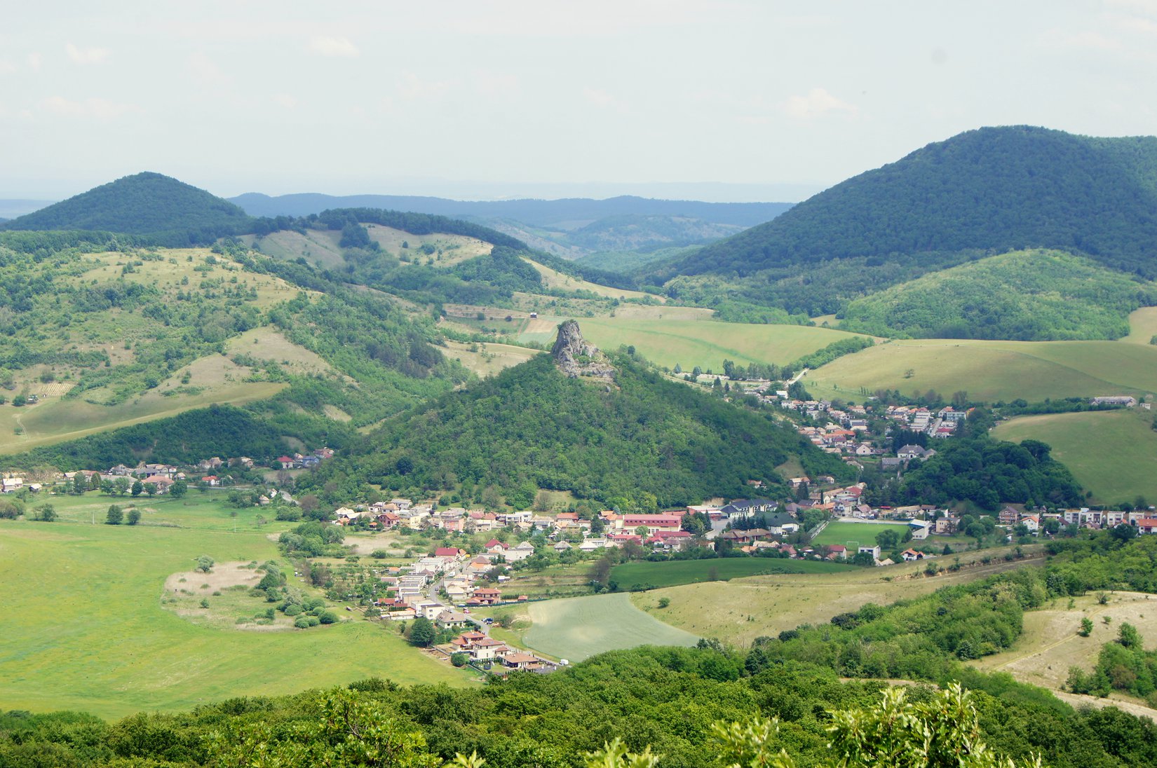
Hajnáčka and its surroundings are among the most attractive destinations in the Gemer part of the Cerova vrchovina. A rocky cliff of volcanic origin juts out directly above the village, on which stands the hidden ruins of a castle from the 13th century. An educational trail with information panels will bring you to this landmark of the village after a few minutes.
Not far from the village is Kostná dolina, a site of bones of tapirs, mastodons and other animals living in the Tertiary Mountains. The abandoned quarry above the entrance to it is often referred to as the most important Carpathian site of blue gemstones (sapphires) in basalt.
Popular destinations in the vicinity of the village are the hills Ragáč (537 m above sea level) and Pohanský hrad (578 m above sea level). They are connected by a green marked tourist route and approximately the same ascent time of 1.15 hours, but in the opposite direction to each of them.
The pagan castle hides the remains of the stone rampart of the ancient Celts, the remains of a Slavic fort and also a rock town with over 30 pseudokarst caves that were once inhabited by our prehistoric ancestors.
Ragáč is the second youngest volcano in Slovakia, the top of which is a cinder cone with cinder bombs, debris and fragments of lava.
The third unique destination, a bit more distant, is the Steblová skala (486 m above sea level), which can be reached after the yellow and green tourist signs. Exemplary dissected volcanic formation with significant columnar basalt separation. Around 35-60 cm thick columns are exposed to a height of up to 50 m and arranged in the form of an inverted fan. While at the top they are almost vertical, below they are bent at an angle of 40-60°.
But not only from a geological point of view, Cerová vrchovina has a lot to offer.
Fishermen or visitors looking for relaxation will find their way in the quiet coves of the Petrovce water reservoir near Gemerské Jablonec, which is also a nesting place and stopover for migrating waterfowl. In its vicinity is the Beležír protected area, declared for the purpose of protecting the ground squirrel. A few kilometers further on, there is a magical narrow valley with a preserved marsh biotope and today very rare elements of fauna and flora - the Fenek protected area. You can get to it by following the yellow marked tourist route from the village of Petrovce.
In the southernmost tip of the region, above the village of Tachty, the 11-meter-high tower of the village guard lookout tower. It provides a nice view of the entire surroundings, of part of the Cerová vrchovina mountain range, the nearby water reservoir and Hungary, which is only a kilometer away. The interesting thing is that in good weather you can see Kráľova hola up to 80 kilometers away from it.
Kategórie: #Nature